p
e
r
s
o
n
a
l |
Pac Tom website and Level 2
(21 Feb 2010 at 12:44) |
I'd like to introduce you to the Pac Tom website, where I'll be organizing my project to run the length of every street in Pittsburgh. New look, look:
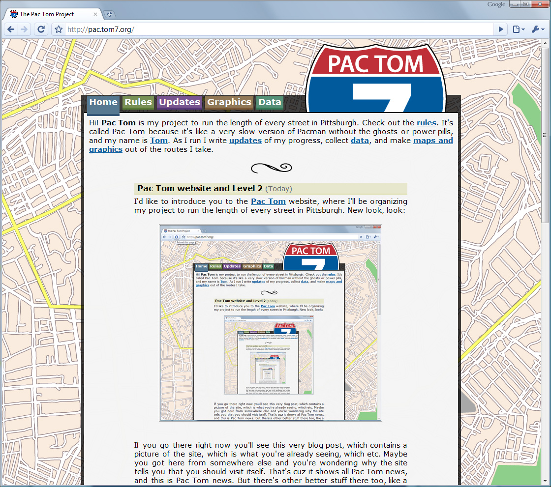
If you go there right now you'll see this very blog post, which contains a picture of the site, which is what you're already seeing, which etc. Maybe you got here from somewhere else and you're wondering why the site tells you that you should visit itself. That's cuz it shows all Pac Tom news, and this is Pac Tom news. But there's other better stuff there too, like a new description of the rules, downloadable KML files of my routes, and brand new maps. Here's the main one:
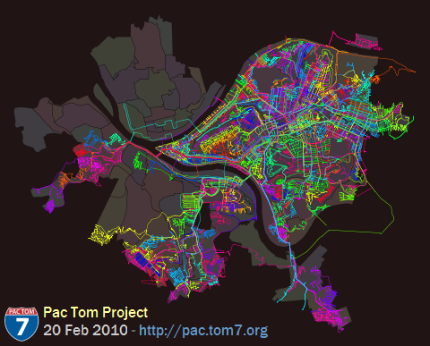
In post 1039 I congratulated myself on finishing Level 1, which is all the roads between the Allegheny and Monongahela rivers (conspicuous sinuous voids in the map above). That was over a year ago, and since then I've made significant progress on Level 2, which is the rest of the city. Each of the colors in the map above is a different trip, though some trips get the same color because there aren't that many colors and they're assigned randomly. I finished off the remote colony of Lemingon-Lincoln-Belmar that's across the river to the far Northwest in one go. (It's pretty weird that this is part of the same neighborhood or even part of Pittsburgh; it's almost entirely a shopping plaza. Must be a tax thing.) The rest of the year has been spent on the neighborhoods to the south of the Mon.
This is way harder than Level 1 was. Obstacles: It's about 6 miles of running just to get from my house to new roads, which I also have to do on the way back, so a minimal trip is 12 miles; they're usually more like 20 so that I can get deep down there and then cover some streets. You can tell from the map that I've been favoring the roads that closest to the borders. I like to do this so that I can "finish off" the periphery and not have to worry about it again; on the way there and back I can pick up some new roads shotgun style. (I'm almost done with South Side flats only via taking different routes through it on my way to other places.) The furthest points imply about a 30-mile round trip (you can see them way off to the West). I haven't done those yet, but I have done some 30-mile trips, so I know it will be possible and painful. Obstacle #2: This area of the city is ridiculously hilly. Level 1 sure had some steep streets but the South Side and West End are worse. Just getting there means running up the Slopes or Mt. Washington, and then the hills roll on. Garmin Connect, which is what I hook my GPS into, pretty much always assumes that the physical activity I'm doing is "Stair Climbing" based on the elevation change. The steepest paved road in the world is there, in Beechview! I'm not complaining, though. I love it.
One of my favorite things to do with the thousands of miles of GPS data that results from the project is various visualizations and computation. There are some more maps on the site and some more coming. I'll post about these soon. |  |
|
| 527 |
| Sweet. I like all of the graphics, like the road sign and the infinitely scrolling map background. You should add a progress bar to the home page showing the percentage you have left and a counter for the total number of miles run. Including a Google Map widget of all your routes would be cool also. |
A: I do not understand your numeric utterance.
J: Thanks for noticing the infinite background. It took me almost a whole day to make it; rather a hard problem for Illustrator to tackle, it turns out.
I like the idea of having a progress meter, but I since I don't have the Pittsburgh road data in any form that I can load up, I can't actually compute how much I've got left. I could do a progress meter of neighborhoods, I guess. You're right that the site needs some straightforward way for people to follow my progress. Total number of miles run I have at hand pretty easily and it's probably the next feature to go up there. Google Maps unfortunately can't handle (or rejects on policy grounds, I can't tell) my map data, which is almost ten megabytes. Google Earth works just fine though, so other than its embedability, you can just click the pactom.kmz to zoom like crazy. |
| Tom: two things. Thing the one, you never do anything halfway, do you? Thing the other, will you change the first post to keep it up to date with what is actually on the home page? If so, is the process automated already? If not, how do you sleep at night? |
| A+ ON TILING THE BACKGROUND IMAGE |
Oh, if only it were true. I am obsessive about some things for sure but most of my secret projects end up unfinished. :(
2: I haven't yet tried to sleep since posting it, so I'm not sure, yet. |
One aspect of this project really appeals to me, and that is that you get to see every part of the city. I'm tempted to try something similar but wimpy, such as biking every street in (comparably-sized) Washington, D.C.
Is there any open-source Linux type software that I could use to track progress, together with a GPS? |
My source codez are all open but a little bit Pittsburgh and Me specific, and they're all in SML. In any case you'd need a way to get KML files from the GPS.
I think that most GPS interfaces are standard, or that there's some small set of standards. There must be linux software out there, but I don't know about it. The Forerunner 305cx is probably not an example because it uses wireless ANT+ to sync. |
|
|
|
|